|
|
|
|
Some Smiths |
|
|
|
Gabriola Island LoopGabriola Island, BCDirections:We park in the Port Place Mall parking lot (49.16556, -123.93229) and ride across the street to catch the Gabriola Island ferry. Schedules for the ferry can be found here. Conditions:The roads are paved and wide enough to avoid the traffic, which on weekends is fairly light. The 30km route is very hilly and a some effort even with eBikes. We saw several people who cycled it on road bikes but they looked very fit! The Trip:
The road is not always next to the sea, so you get forest and ocean views intermixed. You can stop for a sandwich lunch near the end of the trip at Mad Rona's Coffee Bar. It's funky and great food.
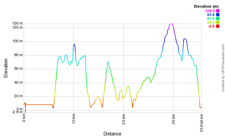
Map:Here is a map of the route on Google Maps with a link to the .gpx file: Gabriola Island Loop Elevation ProfileThe hills start right off the ferry and there are a couple of other big ones.
|
|
