|
|
|
|
Some Smiths |
|
|
|
Calgary Bike PathsCalgary, ABDirections:Calgary has approximately 1000 km of multi-use paved, off-road paths, mostly along the Bow and Elbow rivers in the city. All of the routes below are loops and can be joined at any point along them. Conditions:The trails below are paved and easy to ride, although you will find the occasional root bump or a crack from winter weather. Edworthy to Inglewood Loop:
One of the things to watch for are the hundreds of people rafting down the Bow River every warm day in summer. It's fun and the people doing it are obviously having a great time. If lunch is in the plan, there is a quaint place with OK food at Edworthy called Angel's Cafe, or you can find many restaurants in the Kensington or Eau Claire areas. Map:Here is a map of the route on Google Maps with a link to the .gpx file: Edworthy to Inglewood Loop Inglewood to Fish Creek Park and Return:This route starts at my sister's home in Inglewood and travels along the West side of the Bow River to Fish
Creek Park. Another good place to start is at the corner of New Street and 1st Street SE (51.04206, -114.02514). Fish Creek Park is a wonderful place to ride as well, with many trails throughout its boundaries. There are several entrances to the Park with ample parking space to leave your car (don't leave valuables behind though, as there are car trunk thieves around).
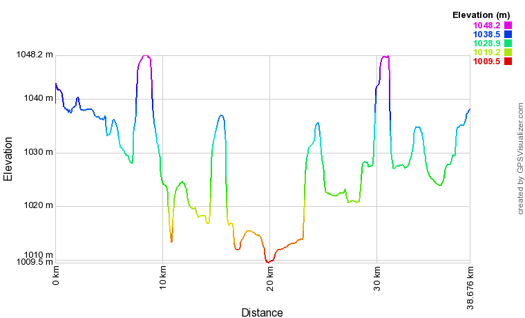
There are a number of places along the route where you could stop for a picnic lunch, especially if you included an extension into Fish Creek Park. Map:Here is a map of the route on Google Maps with a link to the .gpx file: Inglewood to Fish Creek Park Elevation Profile:Although the profile below looks aggressive, the range of change is only 40 meters. There are a few fairly good hills where the river is bounded by steep banks and the trail climbs to go over them. No problem for a cyclist who's fit or has an eBike!
|
|
